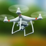
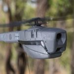
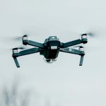
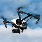
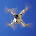
In the public debate and in the work of national and EU legislative bodies, a lot of emphasis is placed on the use of drones to provide services to a wide audience – mainly urban residents. Also the U-space concept, which is being implemented legislatively, is associated with urban centres with higher population density. It is in cities that the main markets for carrying out aerial work using unmanned aerial vehicles are identified. Rural areas are somehow overlooked when analysing the mainstream debate on commercial drone use and sparsely populated areas may seem to be primarily good ‘training grounds’ for practising one’s ‘drone’ skills.
The belief in the urbanity of drones is fundamentally flawed. Although the first areas of use of drones focused on the military area [1], already a dozen years ago – when describing the innovative technology and its possible applications – recognition, patrolling and detection of objects, collection and transmission of information, but also saving human lives, fire prevention or various types of environmental research were mentioned. Specialist services for which drones would be used included agriculture, including precision agriculture [2]. However, the use of drones by public order and security services and authorities has received particular attention [3]. This area includes fire detection, monitoring the state of rivers and dykes, searching for missing persons in the mountains, inspecting the technical state of pipelines or energy transmission networks, monitoring national borders, tracking people or vehicles, observing forest areas for pests, fires, etc. [4]. Many of the above applications are specific to rural areas. One might even venture to say that still the majority of work using UAVs can be and probably is carried out in rural areas rather than in densely populated cities.
In this context, mention may be made of the document ‘Application of services provided using unmanned aerial vehicles (UAV services) to increase the efficiency, effectiveness and quality of public service provision by local government’, which contains a preliminary classification of twelve types of drone applications, taking into account the technical capabilities of the devices and the nature of the tasks they perform [5], while the study ‘Introduction to the issue of the use of drones in local government‘ identifies, using a six-level scale, the potential for drone use by local government units. These uses can apply to both urban and rural areas. The assessment of drone usability was carried out in relation to the individual public tasks of the municipality, district and province. The document relates the significant potential for drone use to such tasks as:
- in the case of the municipality: maintenance of public order and spatial order, supply of water and other utilities or environmental protection;
- in the case of the county: flood prevention measures, public transport and road maintenance, ensuring public order or the promotion of the county;
- in the case of the province: guaranteeing public safety, surveying and mapping activities, and land use planning [6].
The use of drones in rural areas also fits in with the idea of the ‘smart village’, a concept for the development of rural areas located within the European Union. Its primary objective is to solve the social, economic and environmental problems faced by modern villages. This should be achieved, inter alia, by using information and communication technologies to increase the attractiveness of the rural infrastructure, as well as raising the awareness of its inhabitants in this regard. The smart village concept has found its place in the Strategic Plan of the European Union’s Common Agricultural Policy 2021-2027 [7], one of the objectives of which is to increase market orientation and competitiveness, including a greater focus on research, technology and digitalisation. It can therefore be assumed that the implementation of the smart villages concept is not only a political and economic objective of the EU Member States, but a legal task. In accordance with the provision of Article 174 of the Treaty on the Functioning of the European Union, the European Union should devote particular attention to rural areas, which will translate into harmonious development of the entire Union and foster its economic, social and territorial cohesion and reduce disparities between the levels of development of different regions. The use of drones in the countryside fits into this concept.
Drones are a tool to support precision agriculture. Unmanned aerial vehicles, which are equipped with digital cameras, are excellent tools for monitoring and collecting data on the current condition of agricultural fields, creating the conditions for expanding the universality and efficiency of precision agriculture. They make it possible not only to monitor the condition of crops, but also to accurately calculate the areas affected by various types of natural disasters. Farmers thus have access to tools that enable them to react quickly to any adverse changes and problems.
However, the importance of drones in agriculture goes much further. Today’s agricultural drones, thanks to their advanced technology, can be used to monitor soil moisture. This allows farmers to optimise irrigation, tailoring it to the individual needs of a particular section of the field. This means greater efficiency in the use of water, which is particularly important in regions affected by droughts.
In addition, increasingly sophisticated algorithms allow drones to analyse images and data in real time, providing farmers with immediate information. This allows farmers to make quick decisions, such as spraying a specific area of the field, before the problem spreads to larger areas.
The educational potential of drones cannot be forgotten either. With their increasing popularity, courses and training dedicated to the use of drones in agriculture are emerging. Farmers are learning not only how to use these advanced tools, but also how to interpret the data collected. Such education certainly contributes to the efficiency and competitiveness of farms, which is particularly important in the context of the smart village concept.
In the context of precision agriculture, the use of UAVs to create area maps and orthophotos is particularly relevant. Using multispectral cameras installed on board UAVs, a map can be easily created, whether standard or using infrared technology. An area map created in infrared allows farmers to assess in detail the condition of a given crop and, consequently, to make rational use of fertiliser inputs. This method is part of precision agriculture and provides significant savings on the purchase of fertilisers. In addition, infrared maps make it possible to determine the time when damage occurred in a crop field, which can be important in potential insurance claims.
The use of drones and satellite technology to control European Union subsidies represents a significant advance in the efficiency and accuracy of monitoring agricultural operations. It is an innovative response to the growing needs of both the Agency for the Restructuring and Modernisation of Agriculture (ARMA) and the farmers themselves. Unmanned aerial vehicles have been used for several years to provide technical support to the ARMA’s control mechanism for European Union subsidies. Until 2018, the primary method of control envisaged by EU regulations was the physical visit of officials to the agricultural site. Currently, the Agency uses, among other things, satellite imagery systems and monitoring of fields by unmanned aerial vehicles.
Although the technology is only in its early stages, drones could also be used to fertilise half or spray weed or pest control substances on crop fields. Fertilising crop fields with drones would definitely be beneficial to the farmer due to time savings and lower labour input. One obstacle is the lifting capacity of drones, which are generally not designed to carry as much heavy and voluminous matter as agricultural fertilisers. At present, drones with payloads of up to 30 kg are used, giving residual capacity for use in fertilising fields. This process could prove particularly valuable for locations where traditional fertilisation methods are hampered by terrain or other unfavourable geographical conditions for agriculture.
Despite technical limitations, the use of specialised agricultural drones, which are designed by design to spray fields, is becoming increasingly important. This possibility is particularly important when considering the farmer’s work with harmful pesticides. Currently, there are already companies selling specialised agricultural drones in Poland.
Due to the myriad of modules that can be installed on board an unmanned aircraft, the use of drones in agriculture can take a very broad spectrum of forms. One possibility is to fit a frequency-specific sound emitter, which can have a pest and insect deterrent effect. Combined with the precision agriculture discussed earlier, which involves the constant collection of information on the condition of crops, a farmer can quickly identify the occurrence of pests on his or her land and then immediately initiate measures to combat crop-destroying insects. A branch of agriculture for which this use of drones can be particularly useful is fruit farming. This is because the signals emitted by the aircraft are able to effectively deter birds whose presence in orchards devastates the fruit harvest.
In addition, drones are excellent for improving the collection of documentation for agricultural damage assessments. They help identify and enumerate the area of land affected by weather (drought, hail, flooding, etc.) or wildlife and take detailed photographs. This data can be used as evidence to accompany crop insurance claims. Aerial photographs of crop fields provide extremely important information.
However, like any technology, drones also have their limitations. In addition to the previously mentioned payload capacity, the problem is the correct application of airspace regulations, which can affect the ability to use drones in certain areas. Additionally, it is necessary to ensure that the data collected by drones is adequately protected so that it does not fall into the wrong hands.
In conclusion, it is important to note that in recent years there has been a rapid development of drone-related technologies and their use in agriculture. As a support tool for precision agriculture, drones bring many benefits:
- Accurate field monitoring: The multispectral camera is able to determine the condition of crops, irrigation levels or identify potential threats in the form of diseases or pests.
- Advanced mapping: Orthophotos give an accurate picture of the crop area, which helps to plan agro-technical measures and respond to potential problems.
- Cost optimisation: By precisely identifying the areas that need intervention, specific areas of the fields can be focused on, rather than treated evenly. This saves crop protection products, fertilisers and water resources.
- Inspection and verification: the use of drones by inspection bodies allows for quick and accurate verification of farmers’ applications and other funding issues.
- Innovative solutions: Sound emitters installed on drones are an excellent example of how technology can help to naturally and non-invasively control pests such as birds in orchards.
- Farmer safety: Spraying fields with drones reduces the risk of farmer exposure to harmful pesticides.
- Damage documentation: Drones offer a quick and efficient way of documenting damage caused by external agents, speeding up the processes of claiming compensation or funding.
Of course, like any technology, drones in agriculture have certain limitations – lifting capacity, operating time per battery charge or legal issues related to airspace. Nevertheless, the benefits of their use far outweigh these limitations. The development of drones in agriculture is an excellent example of how modern technologies can contribute to more efficient and sustainable agriculture. For Poland, a country with strong agricultural traditions and, at the same time, aspirations for innovation, the use of drones in agriculture is not only a step towards modernising the sector, but also a way to increase the competitiveness of Polish agriculture on the international market.
Bibliography
[1] M. Adamski, J. Rajchel, Unmanned aerial vehicles, part 1: Characteristics and use, Deblin 2013; J. Kaag, S. Kreps, Drone warfare, Cambridge-Malden 2014.
[2] E. Zablocki, Lotnictwo cywilne, lotnictwo służb porządku publicznego. Classification, functions, structures, operations, Warsaw 2006, p. 111.
[3] K. Kordalewski, Wave of new applications for unmanned aerial vehicles (UAV) in crisis management [in:] J. Cymerski, K. Wiciak (eds.), Counteracting threats arising from unlawful and intentional use of unmanned mobile platforms, Szczytno 2015, pp. 231-248.
[4] M. Adamski, J. Rajchel, Unmanned aerial vehicles, part 1, pp. 88 et seq.
[5] P. Rutkowski, M. Zych, S. Kosieliński, T. Drozdowski, Application of services provided with the use of unmanned aerial vehicles (UAV services) for increasing the efficiency, effectiveness and quality of public service provision by local government, Warsaw 2018.
[6] A. Izdebska, Use of unmanned aerial vehicles in the tasks of local government units, ‘Quarterly’ 2022, no. 25.
[7] https://www.gov.pl/web/wprpo2020/plan-strategiczny-dla-wpr-na-lata-2023-2027-wersja-40-przyjety-przez-rade-ministrow
